

Reviewers continue to lose up to 40 minutes per permit toggling between applications to obtain a complete site view, delaying projects, creating costly rework, and slowing down community development. Infrastructure projects require spatial context that traditional plan review tools simply can’t provide.
Missing Spatial Context Creates Critical Blind Spots
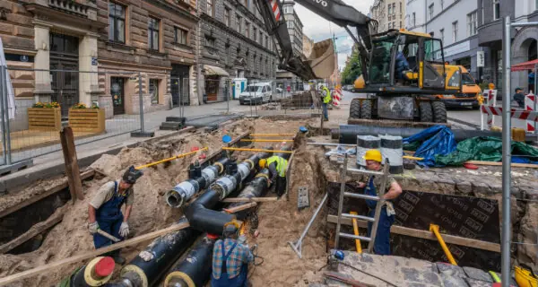
- Missing GIS context hides critical details like underground utilities.
- Reviewers waste time jumping between systems for full-site context.
- Gaps in spatial data create risks for rework, penalties, and public safety issues.
- Utility conflicts drive up construction project costs and timelines.
Siloed Data & Manual Handoffs
- Paper or PDF-based workflows slow down coordination between agencies.
- Lost plans and version control chaos create constant rework.
- No real-time visibility into status of critical infrastructure projects
Strict Compliance Mandates
- ROW permits must meet ADA, traffic-control, environmental, and dig-safe regulations.
- Missing or outdated GIS context triggers rework, fines, and liability.
- Manual compliance checks slow reviews and risk errors.
Aging infrastructure & Limited Funding
- Decades-old infrastructure compete for limited budgets, forcing teams to do more with less.
- Deferred maintenance heightens project urgency and risk.
- Emergency repairs disrupt schedules and drain resources.
your team coordinating emergency fixes instead of building resilient assets and infrastructure your community depends on.
Avolve brings everything you need for Public Works plan review into one place.
As the only electronic plan review software with embedded Esri ArcGIS and AI, your team can review any project in a single workspace, seamlessly integrated with your permitting system—so they can work faster, smarter, and with greater confidence.
Accelerated Permit Approvals by up to 75%
Seamless Collaboration Across Agencies with Instant Visibility
Optimized Infrastructure Decisions with GIS-Integrated Plan Review
AI-Powered Plan Reviews with Automated Checks to Increase Compliance
Proactive Conflict Prevention - Deliver Dollar Savings by Avoiding Utility Clashes and Rework
Frees Your Team to Focus on Strategic Asset Management and Planning

Chicago Department of Transportation
Annual Savings
Chicago Department of Transportation
Annual Savings
Avolve helped coordinate utility work across 30 agencies before issuing right-of-way permits—preventing costly conflicts, reducing infrastructure damage, and saving $24 million annually.

Washington Suburban Sanitary Commission
Permit Approvals
Washington Suburban Sanitary Commission
Permit Approvals
Avolve accelerated permit approvals by 75%, slashing review times cycles from 8 weeks to 2-3 weeks and improved submission quality, cutting rejection rates from 85% to under 15%.


proactive conflict prevention and faster approvals
for Public Works Teams.
Speak with a solution expert to find the right fit for your team.